| |
|
Fortification Definition: Any engineered work
designed to enable a small body of men to resist a superior force which
may attack it. |
|
 |
Fortification is one of the oldest and foremost military arts. It
has grown over time in complexity.
The Art of Fortification began when some prehistoric man took shelter
behind a fold in the ground, a boulder or a fallen tree trunk to protect
himself from the missiles of his adversary, while simultaneously
throwing his own. Prehistoric earthworks gave way to wood and stone,
leading ultimately to the medieval fort or castle in all its grandeur.
The rise of artillery led to new styles of defensive architecture. The
beginnings of post gunpowder fortresses are linked to the Italian
engineers of the 15th century. After them came the great fortress
engineers of the 17th and 18th centuries. Finally, came the revival of
fortification in the middle 19th century due to the perfection of rifled
artillery. But the powerful new weapons of the two World Wars in the
20th century virtually reduced fortification to a redundant science.
Today however, more and more attention is being paid to the possibility
of surviving nuclear attack by delving into the earth. A new, fresh look
at the art of the fortress engineer. |
|
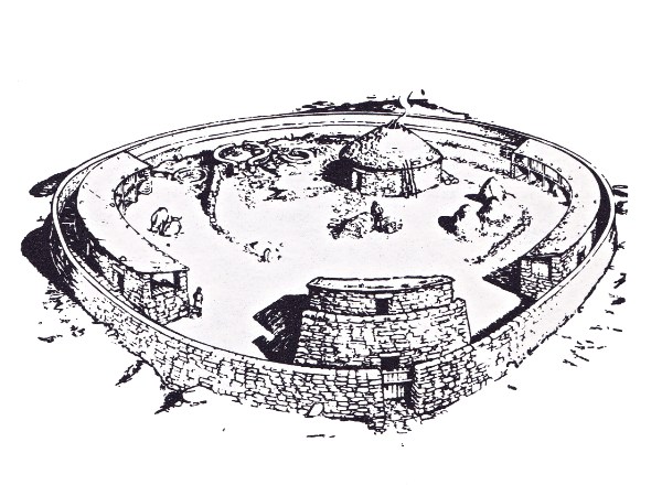
Clickhimin Broch - Early Walled
Homestead of the Picts |
|
Fortification has apparently made insignificant effects upon the
course of history. Very rarely has a fortress absolutely denied an
invader or attacker his desired course of action. Usually,
fortifications sole use has been to buy time, in order to keep the
attacker occupied at bay, while a counter attack could be developed or
allies could come to the assistance of the besieged.
So far as land warfare is concerned, history teaches there has never
been, nor is there likely ever to be, an impregnable fortress.
Fortification is a product of man's ingenuity. Confronted by a fortress,
that same ingenuity, aided often by audacity or reckless endeavor, will
invariably overcome the obstacle.
Costal defense is the master of its own particular field of warfare.
Whenever a coast fortress has been defeated it has been by a land
attack, which they were never intended to withstand. |
|
Usage of the Mortor in a Siege |
|
Concealed Coastal Defense Gun |
|
Above: A disappearing coast gun concealed within a
concreted pit and covered with an iron shield. The gun is down for
loading.
Below: The disappearing gun 'up' for firing. This mode of mounting did
not present the enemy ship with a permanent target. |
|
|
 |
|
Nakhal Fort
Imposing Omani Fortress Surrounded by Date Palm
Trees |
|
Near the North Coast of Oman, in the
Province of Nakhal
Spectacular Fortress that Pre-dates the Islamic Era |
| The pre-Islamic (the exact date is unknown) structure that was the
foundation for later additions to Nakhal Fort was built around a large,
oddly shaped boulder at the base of Mount Nakhal, which occasionally
juts out into the fort’s interior. This is why the fort is an irregular
shape. |
| The fort has been renovated many times since its construction to
protect nearby trade routes, most notably in the 9th and 17th centuries
as well as in 1834 (when the walls, towers, and entranceway were built).
There is a mosque on the first floor and residential and reception rooms
on the upper level. The ceiling of one guest room features beautiful
geometric designs and Arabic writing. |
| From its history of use for defense, Nakhal Fort has acquired a
collection of interesting features, including nooks over doorways where
boiling cauldrons of honey or date juice would wait to be poured on
invaders, and spiked doors for repelling battering rams. |
| Today, the fort houses a museum with exhibits of historic guns and
other artifacts. Every Friday at the fort there is a goat market. The
view from the fort is mostly of date palm trees that fill the
surrounding area, appropriate, since the fort’s name, Nakhal,
translates to “Palm.” |
|
First Ancient Castle Cluster in
North China |
|
View of the Xiangyu Ancient Castle
Located: Qinhe River Valley in Jincheng City - North China's
Shanxi Province |
|
This five-storied house, with a smooth and bright
mirror-like surface in Xiangyu Village
Is by far the best-preserved storied residence in Northern China. |
|
Oldest Roman Fort Protected Soldiers
from 'Infamous Pirates' |
|
Researchers have Discovered
Ancient Fortifications in Italy
The Oldest Known Roman Military Camp
Soldiers here Fought Pirates more than 2,000 Years Ago |
|
These Structures might have Served as the
Foundations of the Modern Italian City of Trieste |
|
The Roman Army was Among the most
Successful Militaries on Earth |
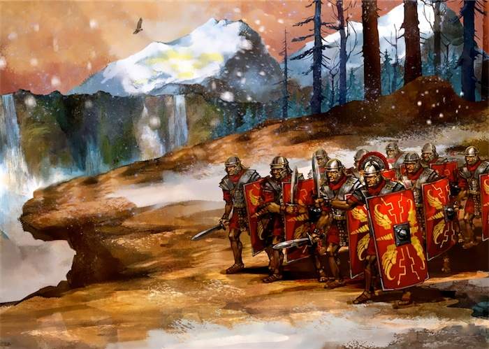
The Roman Army helped to create an empire that spread across
three continents. A key factor behind the strength of the Roman army was
the art of building orderly military camps.
The origin of the Roman military camp remains unclear. Until now, the
oldest confirmed Roman military camps had been located in Numantia and
Pedrosillo in Spain, which date to about 154 B.C. and 155 B.C.,
respectively.
But the recently discovered Roman camp was probably built in 178 B.C.,
thus predating the oldest Spanish camps by decades. These newfound
fortifications may have provided the foundation for the colony of
Tergeste, the ancestor of the modern city of Trieste.
The scientists analyzed the Bay of Muggia, the innermost part of the
Gulf of Trieste, located near Italy's northeastern border with Slovenia.
This is one of the most protected natural harbors of the northern
Adriatic coast, making it a good place to build a settlement.
This military camp was relatively large — greater than 32 acres (13
hectares) — and was defended by imposing fortifications, such as wide
ramparts up to about 80 feet (25 meters) wide. It was located on a
hilltop in a strategic central position about 1.2 miles (2 kilometers)
from the innermost present-day shore of the Bay of Muggia.
Two minor forts flanked the main military camp. One rested on a large
terrace on Montedoro ridge, overlooking access to the Rosandra River,
while the other, at Mount Grociana, overlooked both the Bay of Muggia
and routes leading from the Gulf of Trieste to what is now Slovenia and
Croatia. |
|
Infamous Pirates
This is the first Roman military camp discovered in
Italy, and the newly discovered fortifications were probably created
during Roman wars against people known as the Histri, who controlled the
nearby Istrian Peninsula.
Their objective was also to protect the new neighboring city of Aquileia
from the incursion of the Istrian peoples. Its port was an important
emporium for the trade of wine, olive oil and slaves. Aquileia would
later become one of the capitals of the Roman Empire.
The Roman Historian Livy described the Histri as infamous
pirates.
According to Livy, in the first phase of the conflict, two legions of
Roman Republic were defeated by the Histri, and the camp was lost. |
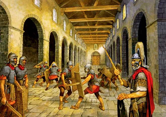 |
Livy reported that the Histri found a lot of wine inside the camp
and got drunk, and this helped the Romans reconquer the camp very
easily.
Pottery fragments at San Rocco revealed that the site dates to between
the end of the third century B.C. and the first decades of the second
century B.C. Investigation of the sites will be crucial to study early
Roman military architecture and the origin of Roman military camps.
The age, size and location of the San Rocco site correspond to a
military camp Livy wrote about that was built in 178 B.C., the
researchers noted. This was a crucial historic period at the borders of
the Roman Republic.
Many European cities originated from ancient Roman military forts,
including Bonna, or Bonn; Vindobona, or Vienna; Eburacum, or York; and
Argentorate, or Strasbourg. |
|
 |
|
 |
 |
|
“And the king said unto them: ‘Take
with you the servants of your lord, and cause Solomon my son to ride
upon mine own mule, and bring him down to Gihon. And let Zadok the
priest and Nathan the prophet anoint him there king over Israel; and
blow ye with the horn, and say: Long live king Solomon. Then ye shall
come up after him, and he shall come and sit upon my throne; for he
shall be king in my stead; and I have appointed him to be prince over
Israel and over Judah.’” (1 Kings 1:33-35) |
|
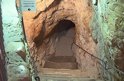
City of David - Ruins |
Passageway to Gihon Spring |
The book of 2 Samuel describes David’s conquest of Jerusalem from
the Jebusites: “And David said on that day: ‘Whosoever smiteth the
Jebusites, and getteth up to the gutter, and [taketh away] the lame and
the blind, that are hated of David’s soul–.’ Wherefore they say: ‘There
are the blind and the lame; he cannot come into the house.’” (2 Samuel
5:8) Following fifteen years of excavations, the possible site of that
conquest and gutter was inaugurated in a secret ceremony which took
place before Passover.
The fortress, built some 3,800 years ago, is being called the Spring
House for its location over the mouth of the Gihon spring. That spring
is the same one where David had his son Solomon crowned as his successor
to the throne.
“When we open the Bible and read about King Solomon who was crowned
here, on the Gihon Spring – today you can come and see: this is where it
happened. This is where it all started,” said the manager of development
at the City of David. |
|
 |
 |
|
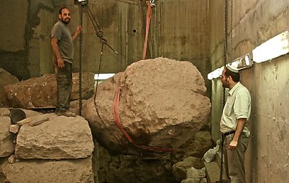
Fortress Eli Mandelbaum Iaa |
Fortress Eli Mandelbaum Iaa - Big Stones |
Spring House was a Canaanite fortress built in the 18th century BCE,
and is one of the largest pre-Herodian structures ever uncovered. It
was excavated in one of the most complex and unique digs ever completed
in Israel. The excavation took fifteen years.
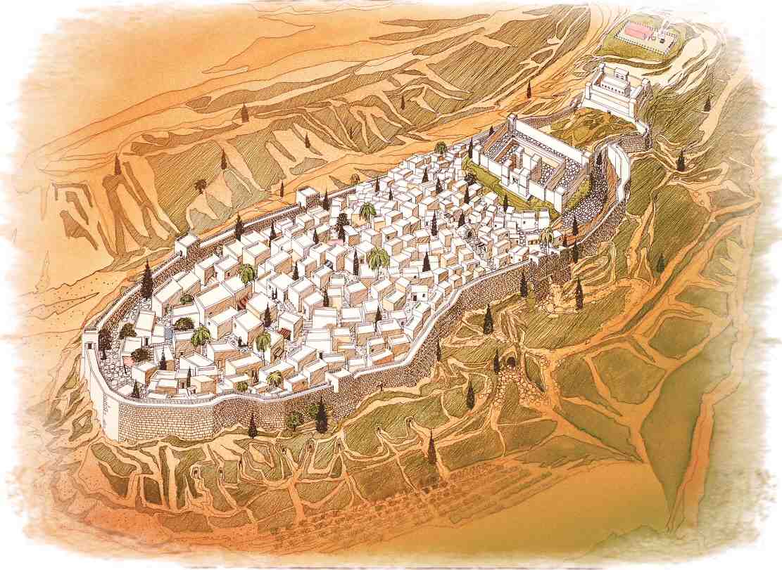
The location and construction of the fortress serve to protect the
spring and allow access only from the western side, within the city.
In order to protect the water source, they built not only the tower –
but also a fortified passageway that allowed the city residents a safe
access to the water source. This very impressive structure was operating
until the end of the Iron Age, and it was only when the First Temple was
destroyed that the fortress fell into ruin and stopped being used.
Excavations at the site actually began in 1867, 100 years before Israel
reunified the Old City of Jerusalem. They were funded by the Palestine
Exploration Fund and led by Captain Charles Warren. The first to reach
the Spring House, however, was treasure-hunter Montague Parker, a
real-life Indiana Jones searching for the lost Ark of the Covenant and
King Solomon’s treasures. He had no authority to dig, so he bribed the
Turks to look the other way as he explored. He operated there from 1909
to 1911, when he was noticed by an alert guard who was not in his pay.
He was forced to flee to Cyprus for fear of his life. The remains of
his century-old excavations can be seen in the fortress’s upper part.
The walls of the fortress are seven meters (nearly 23 feet) thick, and
are made of 2-3 meter (6.5-10 foot) large stones. The fortress was
impressively constructed without the use of mechanical tools. |
|
 |
|
King David's Jerusalem . . . circa
1000 BC |
|
 |
|
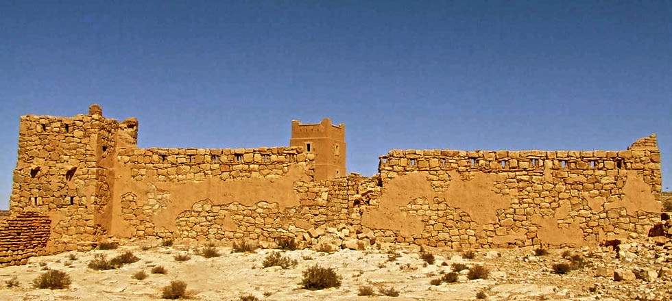 |
A desert fort in Southern Morocco, built by the French Foreign
Legion in 1921, it is situated on a high plateau at the Southern end of
the Oued Guir river valley.
The remote desert outpost, manned by rugged and desperate legionnaires,
surrounded by hordes of camel mounted tribesmen has become something of
an iconic image ever since P C Wren first published Beau Geste in 1925.
In his stirring tale of the French Foreign Legion much of the action
takes place at Fort Zinderneuf, an isolated desert fort which forms the
backdrop to the story. The original story resulted in several Hollywood
films and a whole range of books and films of a similar genre.
In reality the French Foreign Legion was used in campaigns across North
Africa. They did build and garrison isolated forts and such forts did
become the focus of military actions. Outposts being defended to the
last man were not plots in popular novels but frequent occurrences
during the early part of the 20th century. |
|
Photo Below - Fort Interior with
Roofless Inner Buildings |
|
Why Were the Forts Built? |
| The problems facing the French during their occupation of Morocco
were immense. Militarily it was not a simple operation. Climate, terrain
and a fiercely independent population were all against them. The
terrain, in particular, provided a major obstacle to conquest. High
mountains (heavily wooded in the North) were difficult to penetrate
other than through mountain passes that were narrow and steep sided.
Such routes provided easy locations for ambush and became death traps
for many French columns moving through them. Water, a vital requirement,
was available in certain areas and the oases where it was found were
much disputed. Domination of ground and control of the passes and supply
routes would be essential if the French were to succeed in their
mission. |
|
Without effective artillery and methods of forcing entry
into the forts it is likely that the garrisons would have felt
relatively secure from attack. With modern weapons and behind “hard
cover” the greatest threat perceived by most would have been that of a
protracted siege and the gradual diminishing of water supplies. However,
there is literary evidence to indicate that direct attacks on, and
infiltration into, the forts was a very real threat.
Although isolated, the forts did have effective communications with the
outside world using a variety of methods ranging from telephone and
radio to more primitive heliograph, carrier pigeon and bugle calls which
could be used to summon assistance. In addition, after the First World
War, regular over flights by aircraft of the French Air Force would
provide additional cover. |
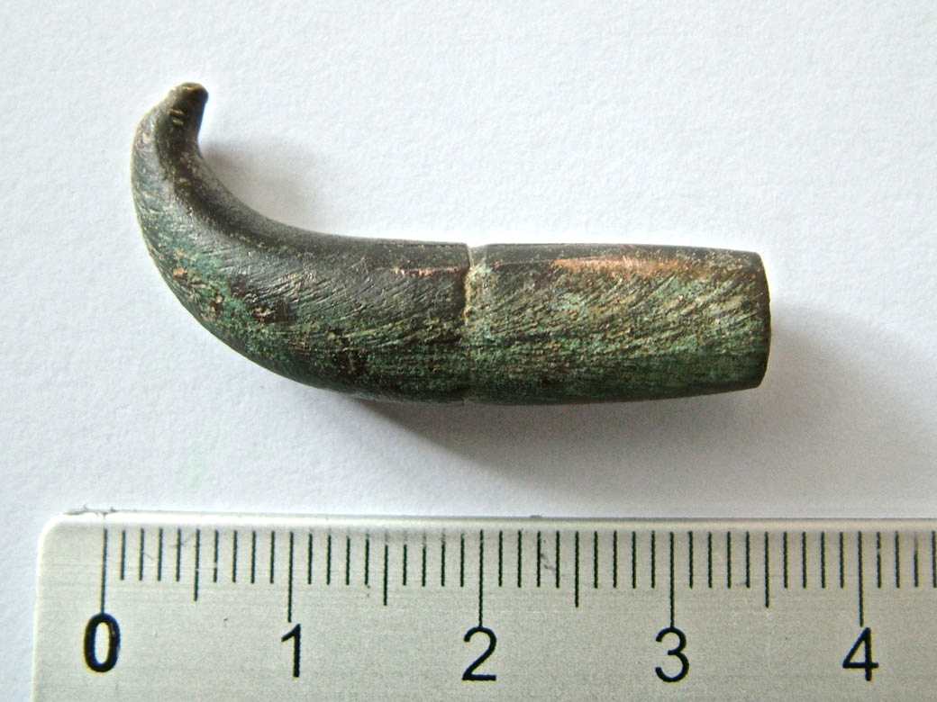
Spent Bullet from the Blockhouse |
The uprising in the Rif Mountains led by Abd-el-Krim in the 1920’s
saw some of the most dramatic assaults on isolated forts. Inspired by
his success against the Spanish in Northern Morocco, he was prepared by
1925, to have a go at the French.
Numerous forts were completely surrounded and cut off from all supplies
and French forces, with the Foreign Legion in the forefront, were
dispatched on desperate rescue missions not all of which were a success.
The Legion suffered a number of defeats at the hands of Abd-el-Krim’s
tribesmen and at least one fort, having held out for almost eight weeks
was blown up by its commanding officer.
Finds including clear evidence of garrison life in the form of ration
tins, tunic buttons and belt clasps. Evidence of military activity comes
in the form of spent cartridge cases, spent bullets and grenade
fragments.
The blockhouse at Boudenib, whilst visible from some miles away, proved
to be very difficult to reach and it was only after several motorcycle
recce operations over a two day period that a route suitable for a
vehicle was found through the ruins of the old Kasbah and oasis tracks. |
|
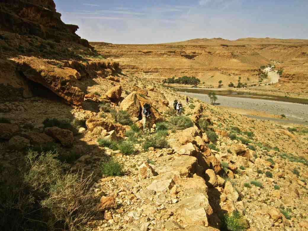
Approach to the Fort from the Valley
Bottom |
Holding a key position covering the Southern approaches to Boudenib
the blockhouse had been subjected to a major attack in 1909. The forty
defenders held off some four hundred attackers for almost two days
before finally directing artillery fire onto the position to clear the
attackers. A Legion equivalent to Rorkes Drift it had been a very close
thing.
Very little now remains of the blockhouse and, surprisingly given the
historical accounts of the attack, very little archaeological evidence
could be located to indicate the severity of the battle. |
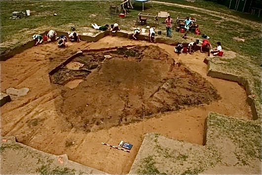
| The remains of the oldest European fort in the inland United States
has been discovered by a team of archaeologists. It is a nearly 450
year-old Spanish fort built in North Carolina’s Appalachian Mountains,
nearly 300 miles from the Atlantic Coast. |
Spanish explorers built Fort San Juan in the foothills of the
Appalachian Mountains in 1567, nearly 20 years before Sir Walter
Raleigh's "lost colony" at Roanoke and 40 years before the Jamestown
settlement established England's presence in the region.
"Fort San Juan and six others that together stretched from coastal South
Carolina into eastern Tennessee were occupied for less than 18 months
before the Native Americans destroyed them, killing all but one of the
Spanish soldiers who manned the garrisons," UM archaeologist Robin Beck
said.
The Berry site, named in honor of landowners James and the late Pat
Berry, is located along a tributary of the Catawba River. It was the
location of the Native American town of Joara. It was part of the
mound-building Mississippian culture that flourished in the southeastern
U.S. between A.D. 800 and 1500.
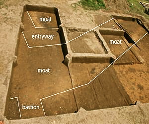
In 2004 the researchers began excavating several of the houses occupied
by Spanish soldiers at Joara, but the remains of the fort eluded
discovery until last month.
"We have known for more than a decade where the Spanish soldiers were
living," Tulane archaeologist Christopher Rodning said. "This summer we
were trying to learn more about the Mississippian mound at Berry, one
that was built by the people of Joara, and instead we discovered part of
the fort. For all of us, it was an incredible moment." |
|
 |
 |
|
 |
 |
Locals say an important cultural site is neglected after years of
battle damage, and endangered by continuing army presence.
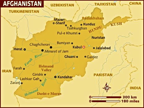
Hundreds of Afghans gathered at the Bala Hissar fortress near the
southern town of Gardez to mark Nowruz, the start of the traditional new
year.
Families celebrated as young men performed the traditional “attan” dance
to the sound of drums.
Nine hundred years after it was built, the ancient fort, whose name
means “high castle”, is still used as a military vantage-point.
“Historical sites like this should be restored and preserved as a
reflection of our history,“ locals said. “But unfortunately, they are
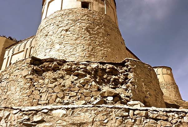
being lost instead.”The high walls appear sound from the outside.
|
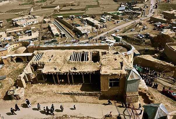 |
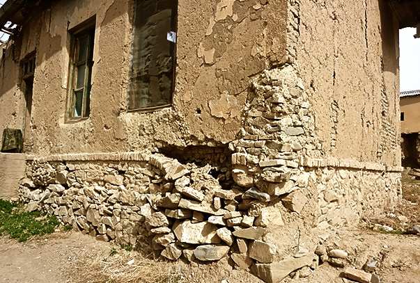
Never-the-less about a third of the structures inside the castle
have been damaged both by earthquakes and by three decades of war in
Afghanistan.
“Most of the damage has been caused by the presence of army forces in
Bala Hissar, such as during the [1980s] Russian occupation, when the
Mujahedin fired rockets at the fort,” local residents said. “Then, when
the Mujahedin took over [in 1992], they used the site to blow up tanks
so as to sell off the scrap in Pakistan. The explosions caused a lot of
cracks in Bala Hissar.”
About a year after the United States-led invasion in 2001, the fort was
the scene of a major battle between the forces of Paktia governor Pacha
Khan Zadran and a rival commander.
Historical strong points across Afghanistan have suffered serious damage
from modern weaponry in recent conflict. The Qala-ye Jangi fort in the
northern city of Mazar-e Sharif is an example. |
 |
It was badly blasted when troops put down a 2001 uprising by Taleban
prisoners held there. That site, too, is still used by the Afghan army.
Noting the destruction done to Qala-ye Jangi and other sites like
Kabul’s wrecked Darulaman Palace, writer and journalist Arefullah
Haq-Parast said a change of policy was essential if they were to be
saved.
“It makes no sense to station forces in historical sites, as many such
places across the country have been destroyed because of the presence of
the military,” he said.
For its part, Paktia’s provincial government says there is little it can
do to protect Bala Hissar, although deputy governor Abdul Wali Sahi
promised action to stop further erosion around the site. |
 |
|
